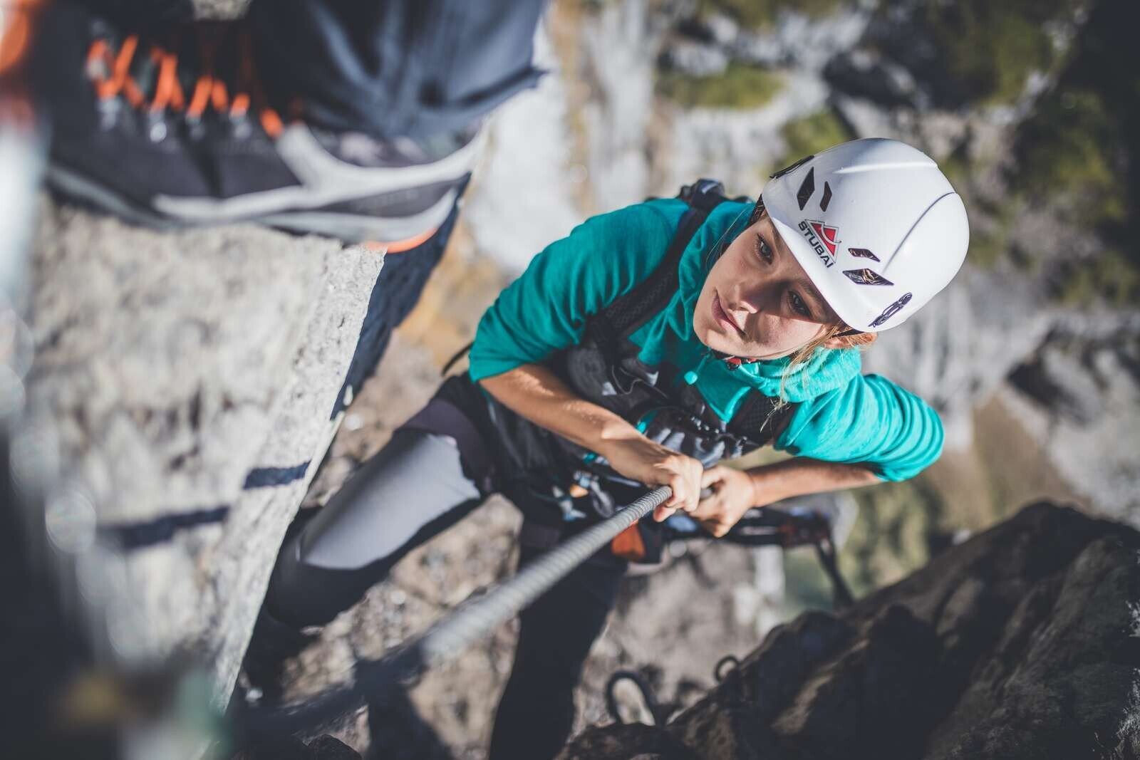
E-Bike and Climb Seebenseegebiet


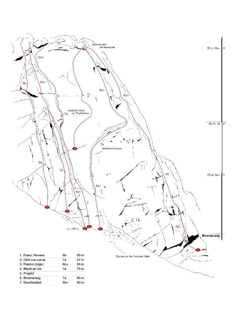
Sport climbing - Coburger Hütte
Sport climbing - Coburger Hütte
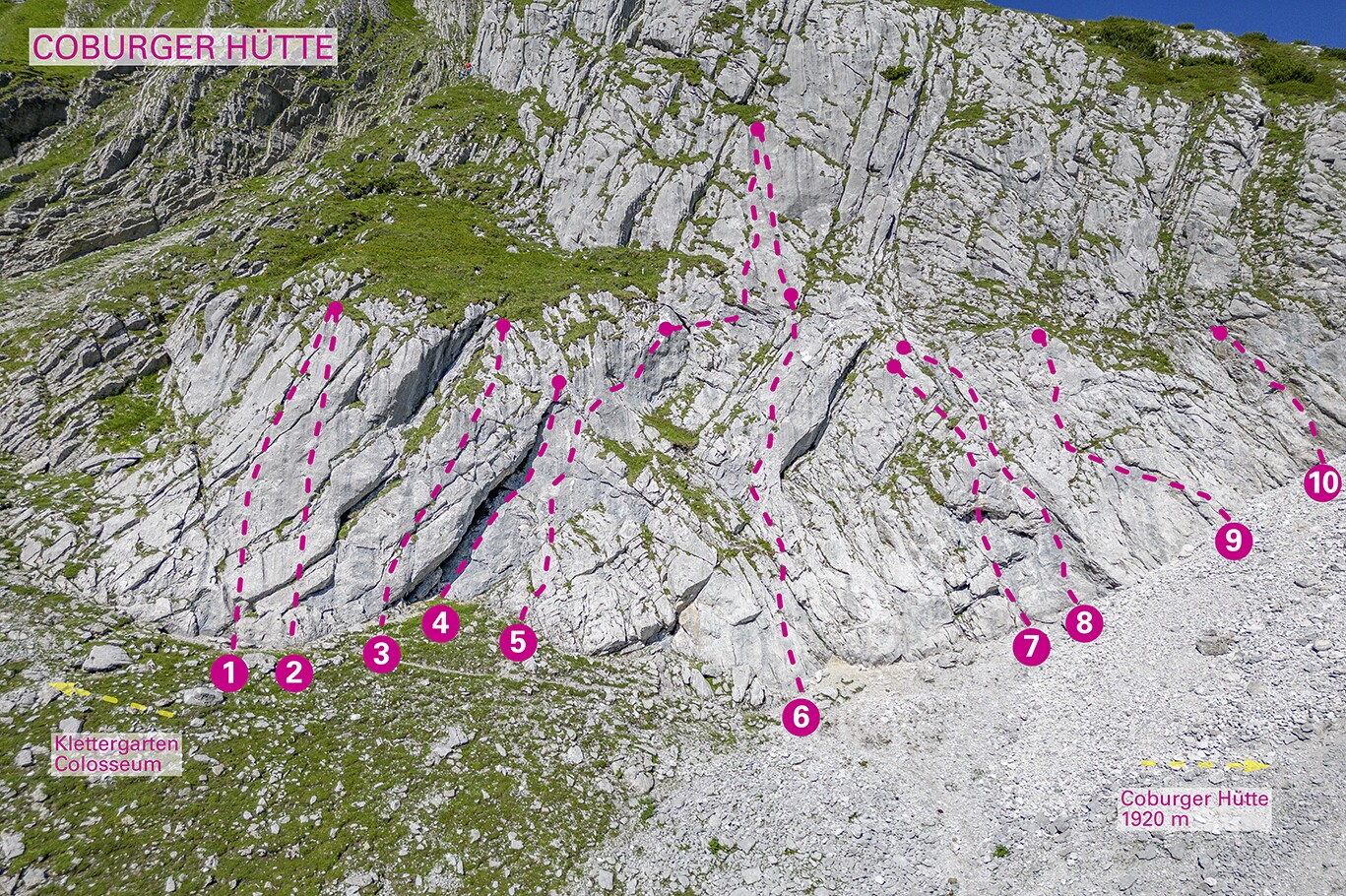
Small but very fine climbing garden near the hut. Best limestone from the Mieminger Gebirge. Grippy and rough. All routes are well secured with bonding bolts.
The hut is approx. 10 minutes away and is an ideal base for a climbing excursion.
Further multi-pitch climbing routes in the vicinity of the lake Drachensee.
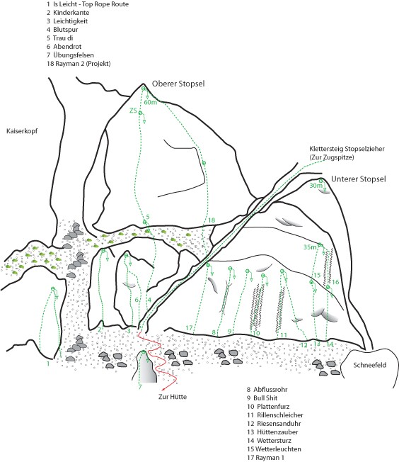
Routes:
Herrenpartie: 4
Gusto huts: 4
Gaber Line: 5
Schnäppsli: 5a
Yeti: 5a
Muggi Fuggi: 5a
Mamayush: 5b
Dragon track: 5b
Overhang: 5b


Coburger climbing path
Coburger climbing path
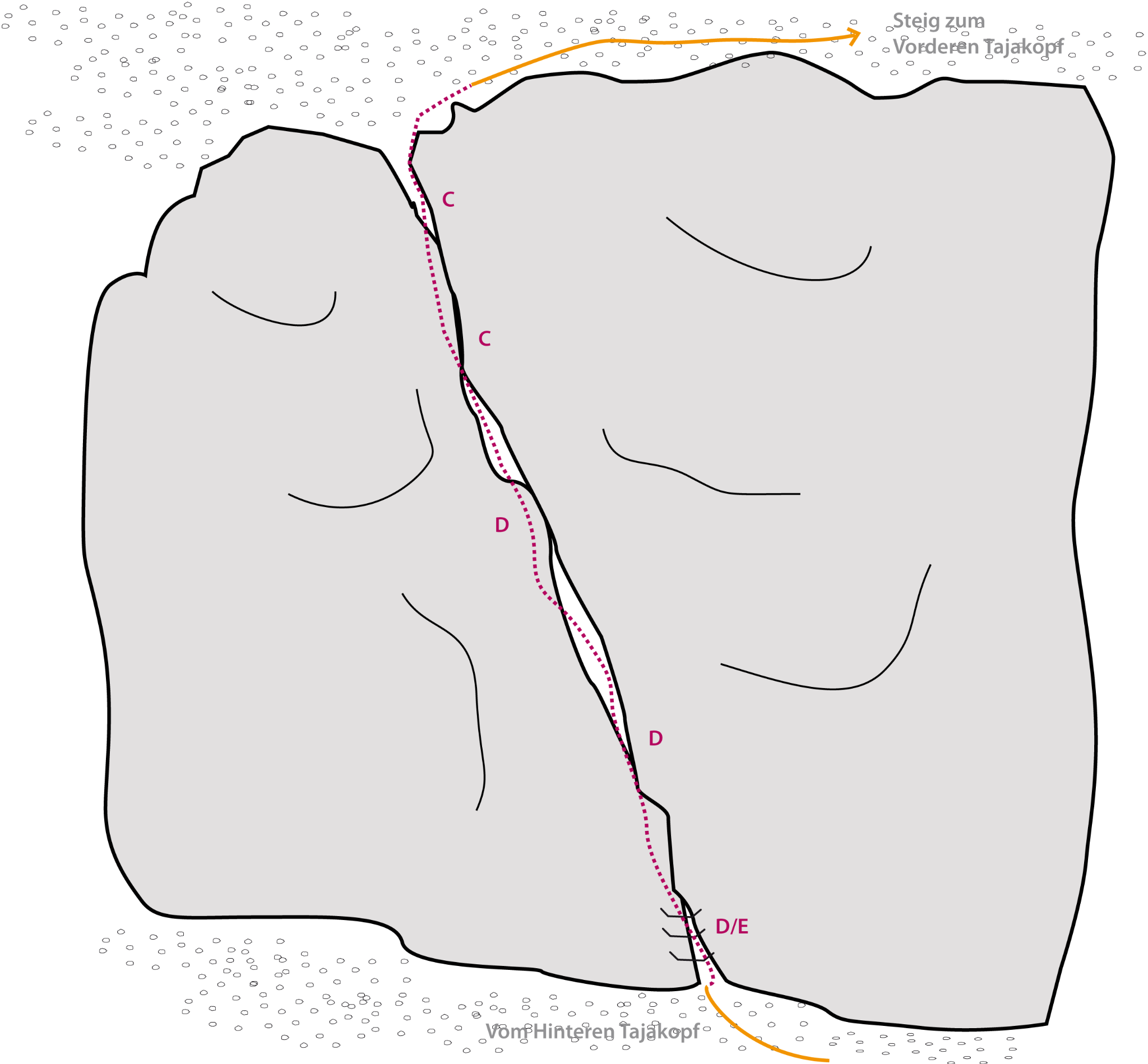
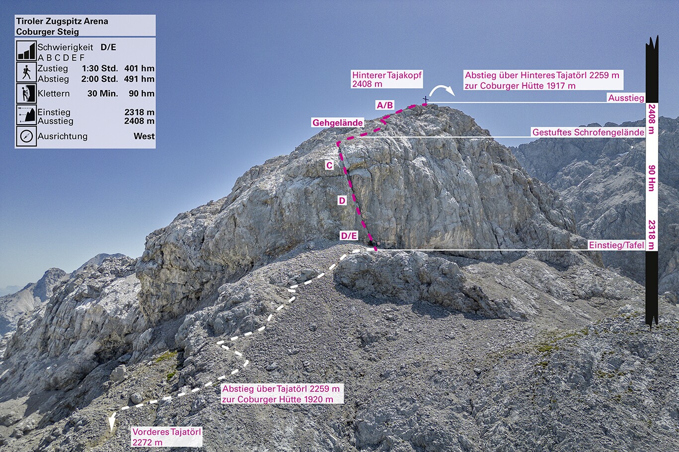
Can be perfectly combined with the “Tajakante” via ferrata and, if you have enough stamina, also with the “Seen Klettersteig” via ferrata. Descent also possible via Coburger Hütte and the Hoher Gang.
A short connecting via ferrata from the Vorderer Tajakopf to the Hinterer Tajakopf, which can therefore also be combined very well with the Tajakante via ferrata.
The actual via ferrata is approx. 50 m long and can certainly be rated D if not E. The start is very easy to recognize, as the footholds and steel cable begin at the foot of the wall. The route continues over steep slabs and small overhangs for approx. 50m towards the summit. The last few meters then lead over a steep climb through gravelly terrain to the summit.
The strenuous ascent, with a breathtaking view over the edge, is rewarded with a magnificent panorama at the summit.
Descent
From Hinterer Tajakopf (2408 m), first descend southwards to Tajatörl via the scree terrain (short, easy scree climbing, sections 1, partly secured with steel ropes). Then descend on the marked trail to the Coburger Hütte (1917 m) (approx. 2 hours).
Descent routes
From the Coburger Hütte via the “Hoher Gang”, approx. 2.5 hours.
From the Coburger Hütte via the Ehrwalder Almbahn mountain station, approx. 2.5 hrs.
From the Coburger Hütte via the Immensteig, approx. 2.5 hours.
Attention: The climb has no emergency exit!


Tajakante via ferrata
Tajakante via ferrata
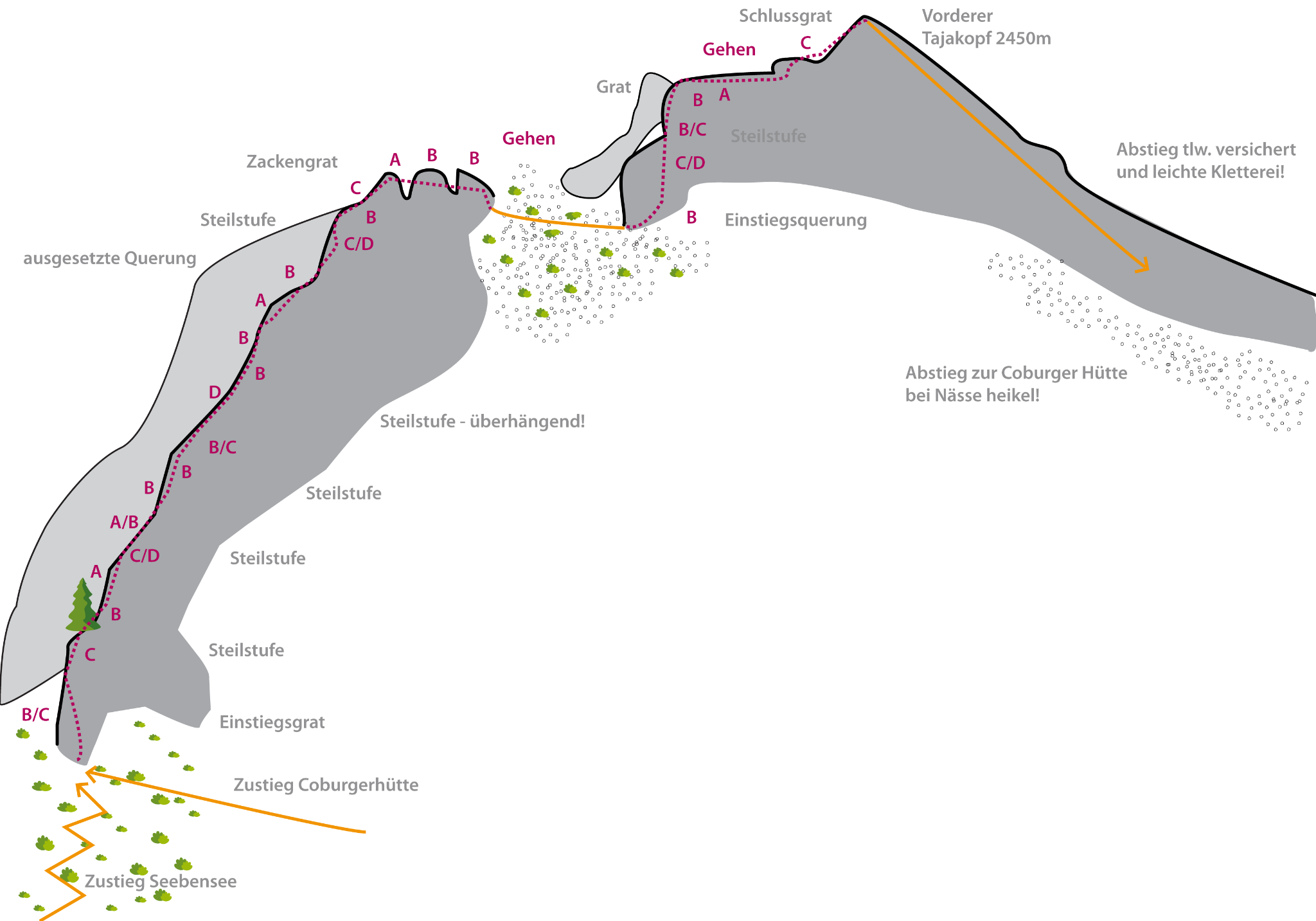
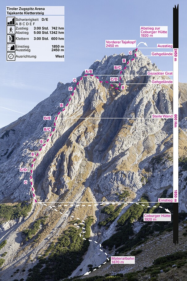
Difficulty class E.
An exposed alpine via ferrata that requires stamina.
An alpine via ferrata that requires stamina.
The via ferrata is not suitable for children.
The via ferrata over the Tajakante offers views of a magical landscape with hundreds of peaks and ridges and jewel-like lakes.
The exciting route leans directly against the ridge and offers everything: great difficulty, great length, great views, geologically interesting surroundings.
Descent
From the Vorderer Tajakopf (2450 m), first descend via scree terrain (partly secured with steel ropes), then on the marked path to the Coburger Hütte (1917 m) (approx. 2 hours).
The descent from the Vorderer Tajakopf runs through steep, alpine terrain. Sure-footedness and alpine experience are necessary.
Descent routes
From the Coburger Hütte via the “Hoher Gang”, approx. 2.5 hours.
From the Coburger Hütte via the Ehrwalder Almbahn mountain station, approx. 2.5 hours.
From the Coburger Hütte via the Immensteig, approx. 2.5 hours.
The descent is alpine. Surefootedness is a prerequisite. Pay particular attention to the weather forecast in the high alpine area. Snow, fog and thunderstorms increase the difficulty enormously.
Caution: The climb has no emergency exit!


Sonnenspitze
Sonnenspitze
Zum Besteigen der Westwand empfehlen wir den Parkplatz an der Talstation der Marienbergbahn in Biberwier.


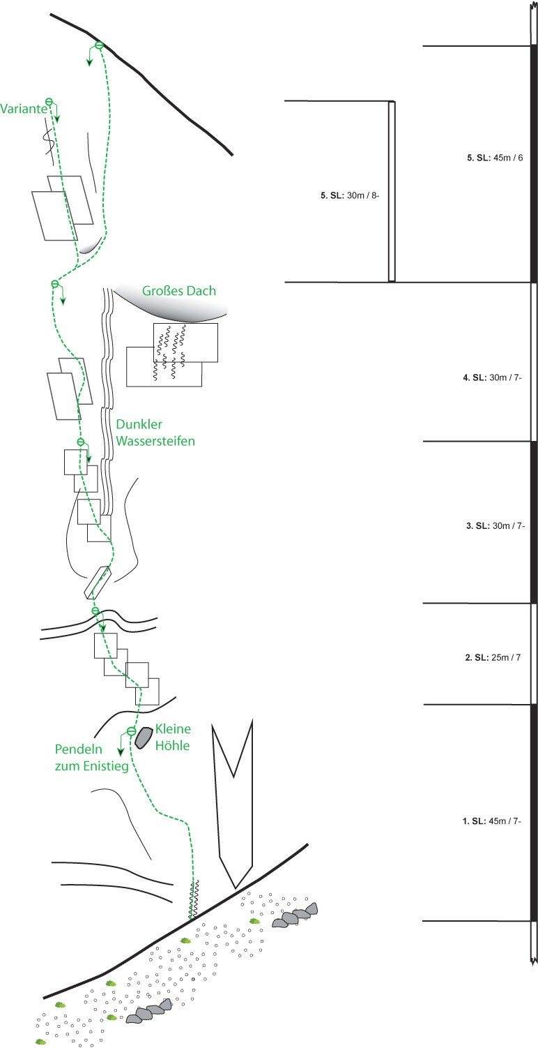
Wampeter Schrofen
Wampeter Schrofen
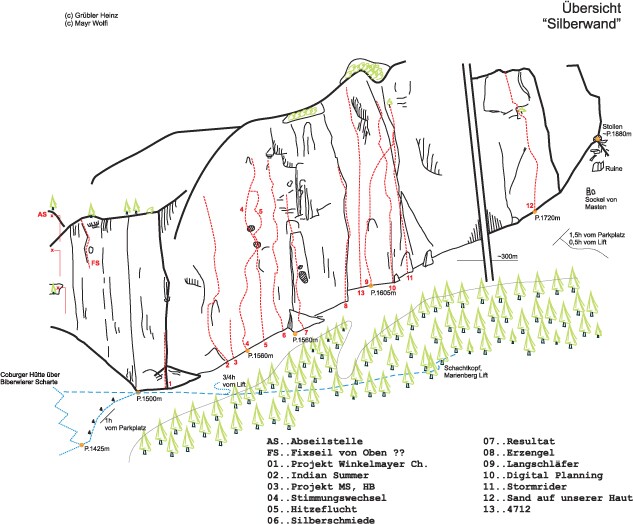
- Die Routen wurden ausschließlich von unseren Allgäuer Kollegen eingerichtet.
- Besonderen Dank für die ausgezeichnete Arbeit sei hier an Wolfgang Mayr, Bernt Prause, Korbinian Prause, Hannes Boneberger, Martin Schwiersch, Jörg Maurus und an all die anderen Helfer, die hier nicht namentlich erwähnt sind, gerichtet.
- Diese Herren zeichnen sich auch als Erstbegeher für diese Routen aus!
- In einigen Routen sind Friends und Keile von Vorteil - siehe Routendetails.
- Der Routenverlauf ist immer, aufgrund der Bohrhaken, eindeutig zu erkennen!
- Beim Abseilen ist auf Steinschlaggefahr zu achten, die andere Seilschaften ebenso gefährden kann.
- Nach Regenfällen sind die ersten beiden Seillängen des öfteren länger nass. Eine "Trockenzeit" ist einzurechnen.
- Aufgrund der Höhenlage kann es an bewölkten oder windigen Tagen sehr kühl sein.
- Achtung bei Gewitter!


Grünstein Nordwand
Grünstein Nordwand