E-Bike & Climb - Seefeld Panorama via ferrata
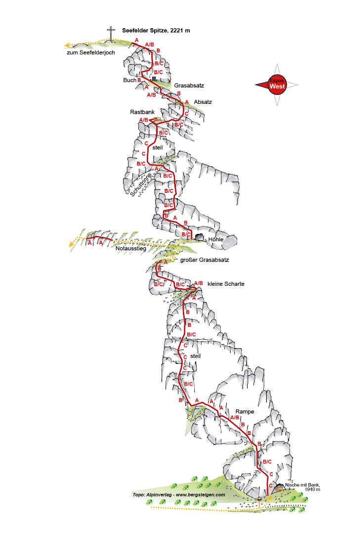

- Altitude difference: 260 hm
- Length: 475 m
- Difficulty: C
- Ascent from the Rosshütte station: approx. 30 minutes
- Descent to the Seefelder Joch station: approx. 20 minutes
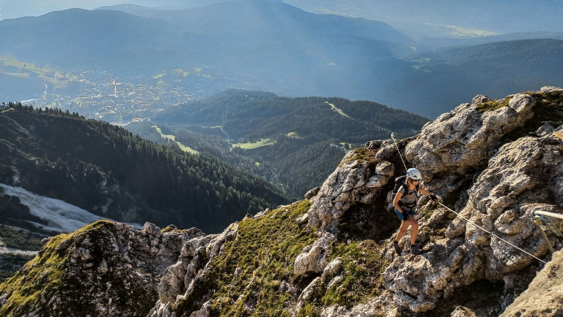
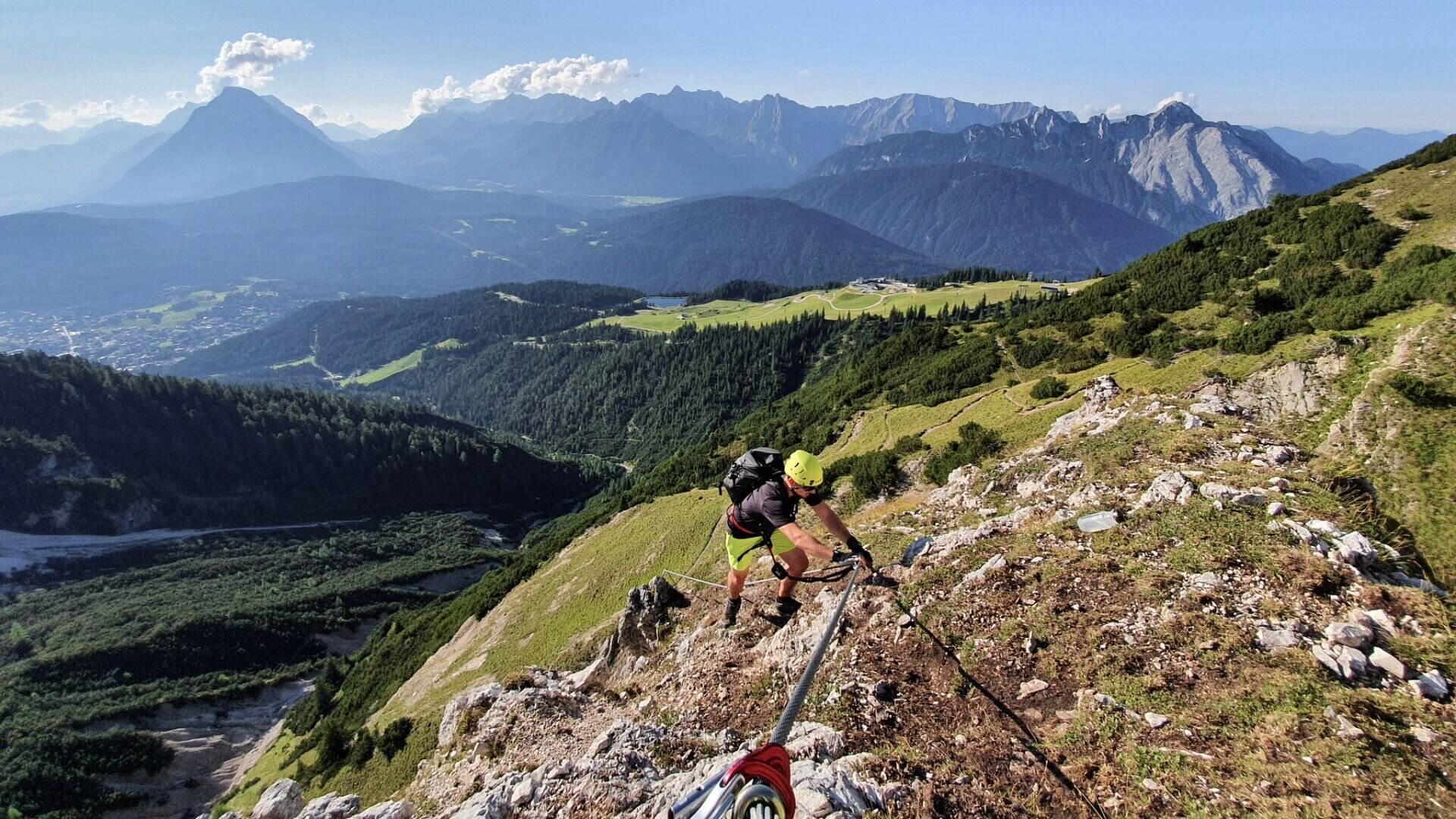
The entrance is at an altitude of approx. 1,960 m, the exit at 2,220 m, thus a total height of 260 m or a length of 475 m is mastered. The difficulty of the via ferrata is in the range C. The walking time is about 1.5 hours. In addition, there is a 30-minute ascent from the Rosshütte station and a 20-minute descent to the Seefelder Joch station. The total time amounts to about 2.5 hours.
For all those who are particularly keen on sports, the ascent from the Rosshütte valley station is recommended, this takes about 2 hours to the via ferrata entrance. Much more comfortable is the ascent with the funicular. This runs in summer every 15 minutes from 9-17 o'clock. The last descent at the Joch is at 16.45.
In "Das Kaffee 2064" at Seefelder Joch you can enjoy small delicacies in the form of coffee and cake after the via ferrata. Also the panorama restaurant Rosshütte at 1,762 m invites you to a stop after the effort in the via ferrata. Let yourself be spoiled by culinary delicacies of the Austrian cuisine.
With our new via ferrata you can enjoy a unique view over the entire region, from the Zugspitze to the Karwendel mountains.
Bei der Bergstation Seefelder Joch lädt das höchstgelegene Kaffee „Das Kaffee 2064“ dazu ein, ein Stück Kuchen und eine Tasse Kaffee zu genießen. Für den großen Hunger, bietet das Panoramarestaurant an der Station Rosshütte eine umfangreiche Karte.
Die letzte Talfahrt vom Seefelder Joch ist um 16:45 Uhr, von der Station Rosshütte (Standseilbahn) um 17:00 Uhr. Es können sowohl bei der Bergstation am Joch, als auch bei der Bergstation Rosshütte (Standseilbahn) Tickets für die Talfahrt erworben werden.
Wer lieber wieder zu Fuß absteigt, biegt auf dem Steig Richtung Seefelder Joch nach kurzer Zeit links ab und wandert bis nach Seefeld.
Eine Alternative für alle Bergsteiger die noch nicht genug haben, ist die Königstour. Sie führt vom Seefelder Joch teils ausgesetzt zur Reither Spitze und erfordert absolute Trittsicherheit (schwarzer Wanderweg). Nach einer Stärkung auf der Nördlinger Hütte kann man bis zur Härmelekopf Bahn wandern und mit der Gondel und Standseilbahn zurück ins Tal fahren (letzte Talfahrt 16.45) oder bis nach Reith absteigen.
https://www.seefeld.com/anreise/mobilitaet-in-der-region