Tiroler Oberland -
Ice Climbing
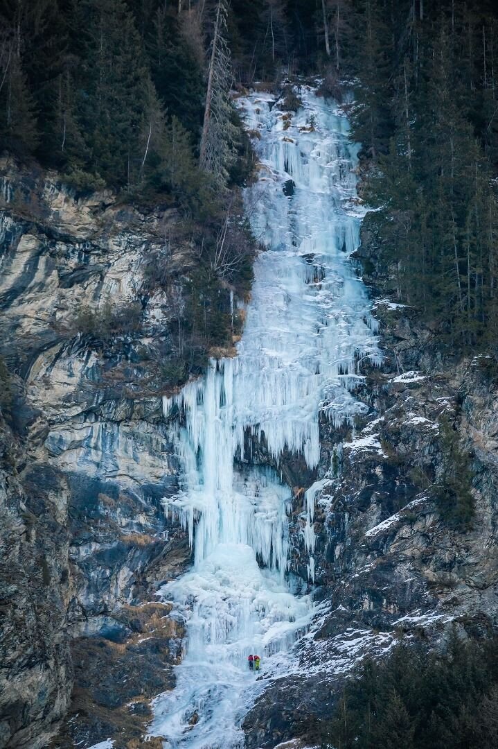
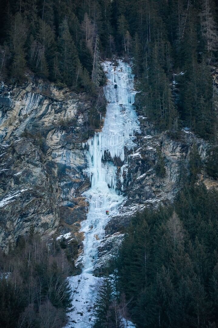
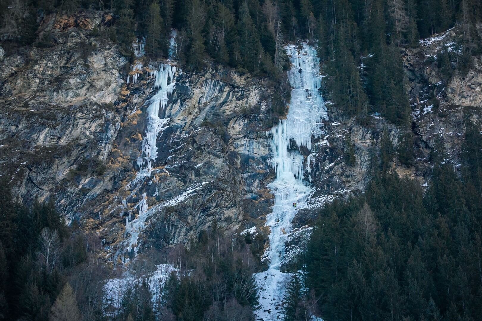
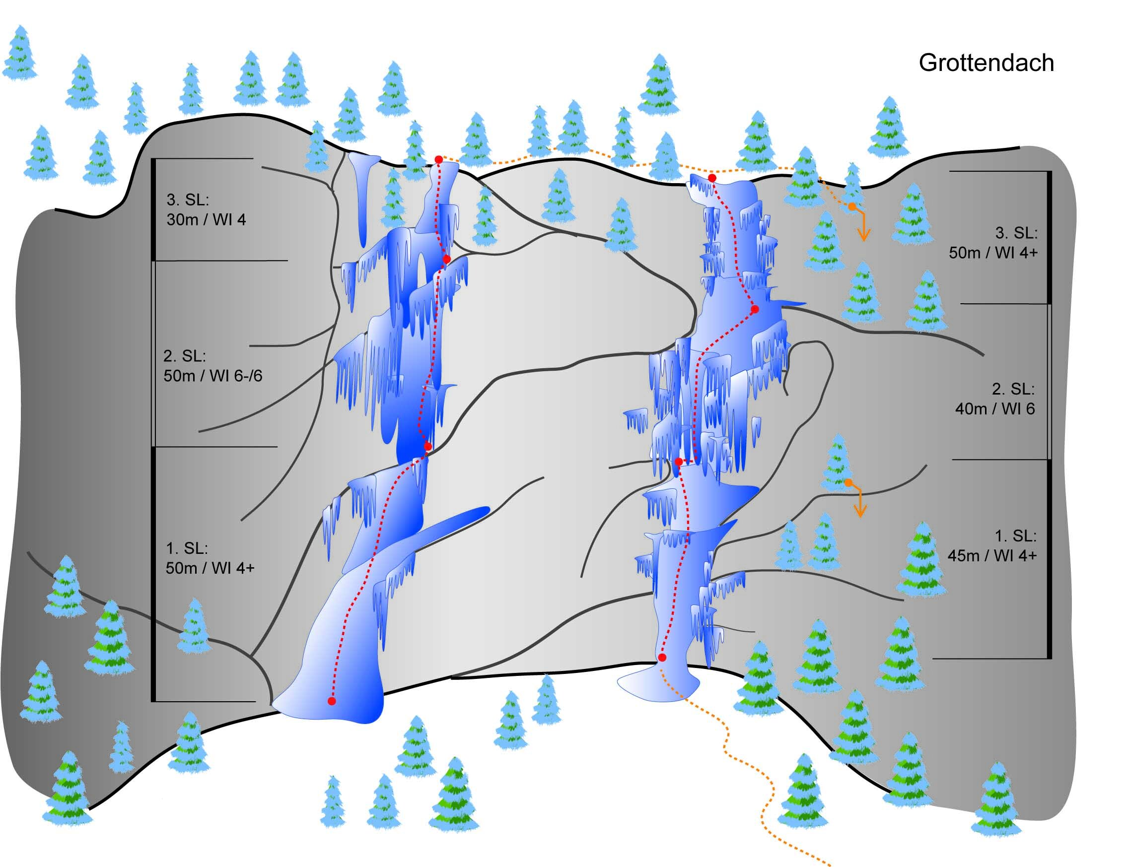
Grottendach - Kaunertal
Difficulty
WI 5 - WI 6
Sea Level
1100 - 150 m
Route length
-950 m

GPS Position / Ascent
All real-time data of the infrastructures can be found in the
fullscreen view of the interactive map
The Grottendach was one of the first difficult waterfalls ever climbed in Tyrol, and was close to the most difficulty rating already back then.
Approach: Parking lot at the Nufels / Kaltenbrunn junction.
Ascent: Cross a meadow below the waterfall, follow the clearing to the entrance. (20 minutes)
Descent: Abseiling on trees and ice tunnels.
Approach: Parking lot at the Nufels / Kaltenbrunn junction.
Ascent: Cross a meadow below the waterfall, follow the clearing to the entrance. (20 minutes)
Descent: Abseiling on trees and ice tunnels.
Public transport
Anreise per Zug/Bus:
Bahnhof Landeck/Zams - von dort mit dem Bus nach Prutz - von da dann mit der Linie 230 dem Bus ins Kaunertal. Fahrzeiten bitte beachten!
Bahnhof Landeck/Zams - von dort mit dem Bus nach Prutz - von da dann mit der Linie 230 dem Bus ins Kaunertal. Fahrzeiten bitte beachten!
Journey
Anreise per Auto:
Wenn Sie aus Norden kommen...
A7 Füssen/Garmisch - B 179 Fernpass - Imst A 12 - Landeck/Zams - Landecker Tunnel B 180 - Prutz - Kaunertal
Wenn Sie von Westen kommen...
Bregenz A14- Arlberg (Tunnel oder Pass) S16 - Landeck - Landecker Tunnel B 180 - Prutz - Kaunertal
Wenn Sie von Süden kommen...
Reschenpass - Nauders B180 - Pfunds - Prutz - Kaunertal
Wenn Sie von Osten kommen...
Wien - A12 - Innsbruck - Landeck/Zams - Landecker Tunnel - B 180 Prutz - Kaunertal
Anreise per Zug/Bus:
Bahnhof Landeck/Zams - von dort mit dem Bus nach Prutz Innbrücke - von da dann mit der Linie 4232 dem Bus zur Haltestelle Kaunertal Platz. Fahrzeiten bitte beachten!
Parking
Ortsteil Nufels