Mayrhofen -
Multi-Pitch Climbing
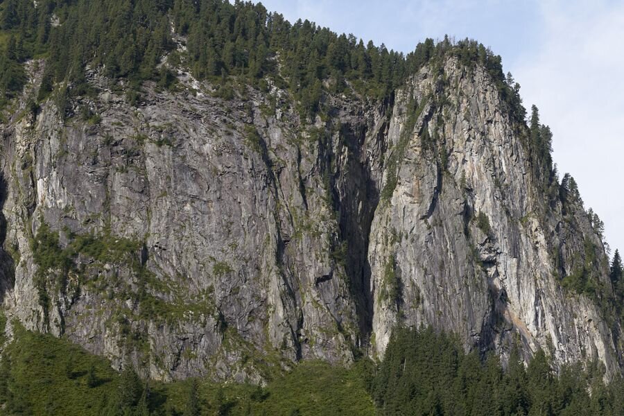
Jägerwand climbing area
Difficulty
6 - 10
Route length
200 - 300 m
Number of routes
64
Sea Level
1600 - 1850 m
GPS Position
All real-time data of the infrastructures can be found in the
fullscreen view of the interactive map
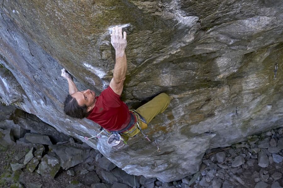
The Jägerwand offers excellent multi-pitch routes in the best rock. In the southern part of the wall you will find beautiful climbs of moderate difficulty. The northern part of the wall, on the other hand, is reserved for specialists, as this part is subject to a high degree of difficulty. Long and very exposed climbs require maximum effort. The wall is sunny in the morning.
The only downer is the long approach.
ACCESS PATH:
Follow the hiking trail to the Maxhütte, which can be reached after about 1 hour. From the hut, a hunters' path leads down the valley. Follow it to the edge of the forest and then walk a few minutes through the forest to the signpost. The walking time from the hut is about 30 minutes.
Rock
Granite
Public transport
Linie 4102, Haltestelle: Naturparkhaus
www.mayrhofen.at/fahrplaene
www.mayrhofen.at/fahrplaene
Journey
From Mayrhofen to Ginzling and on to the Maxhütte car park. This is located shortly after the Ginzling Nature Park House.
Parking
Shortly after Ginzling on the side of the road is the Maxhütte car park.
Mayrhofen - Multi-Pitch Climbing | Jägerwand climbing area
Grischlmühle climbing area
Grischlmühle climbing area
A hidden oasis of climbing awaits explorers in this modest but impressive area. Although there are only a few routes here, they are exceptionally demanding and present even experienced climbers with new challenges. This hidden treasure reveals its true qualities especially on hot days, when the shady rock faces offer welcome refreshment and allow climbing pleasures at higher levels of difficulty. This quiet retreat becomes a true oasis of adventure for all those who want to go in search of unique challenges.
Route overview
level
Quantity
6
1
8
4
9
4
Wall inclination
Rock
Granite
Walking time approach
10
-
15 min
Attractiveness
Protection
Exposure
N
Best season
May - Oct
Access
Follow the hiking trail in the direction of Maxhütte until, shortly before the barrier, a narrow path leads up to the left.
Public transport
Linie 4102, Haltestelle: Leitenhof www.mayrhofen.at/fahrplaene
Journey
From Mayrhofen to Ginzling and continue in the direction of Schlegeis. Shortly after the village of Ginzling you will find the Maxhütte car park. (next to the road)
Parking
Maxhütte car park shortly after the nature park house on the roadside.