Innsbruch und seine Feriendörfer -
Via Ferrata
Innsbrucker Klettersteig
State
Locked until cancelled!
Difficulty
C / D
Via Ferata height
435 hm
Sea Level
2269
-
2480 m
Exposure
S
Best season
Jun - Sep

GPS Position / Ascent
All real-time data of the infrastructures can be found in the
fullscreen view of the interactive map
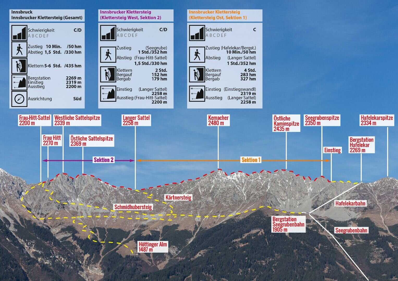
The Innsbruck fixed rope route leads over seven peaks of the Innsbruck Nordkette, accordingly the panoramic view is magnificent. The via ferrata consists of 2 sections. Section 1 leads from the top station Hafelekar 2269 m over the Seegrubenspitze 2350 m, the three chimney tops (eastern chimney top 2435 m, middle chimney top 2435 m, western chimney top 2445 m) and the Kemacher 2480 m to the Lange Sattel 2258 m. Section 2 runs from the Lange Sattel over the Western saddle top 2339 m to Frau Hitt or Frau Hitt saddle 2200 m. The first part with of an original suspension bridge runs mainly on the ridge, the second part is somewhat more demanding and leads over many rock towers, embrasures and steep wall passages. The entire via ferrata has a length of about 3.5 km and offers an incredible view of the glaciated mountains of the main Alpine ridge and the Inn valley.
Walking time approach
10 min
Climbing time
6 h
Walking time descent
1:30 h
Access
Take the Seegrubenbahn to Seegrube and then the Hafelekarbahn to the mountain station, from there follow the signs to the via ferrata
Descent
From the Frau-Hitt-Sattel 2200 m or from the Lange Sattel 2258 m over the Schmidhubersteig back to the Seegrubenbahn 1905 m.
Public transport
Bus line J or take the Hungerburgbahn to Hungerburg
Journey
Linea di autobus J o Hungerburgbahn fino al Hungerburg
Parking
Park in the Hungerburg car park or Citygarage and then take the Hungerburgbahn to Hungerburg